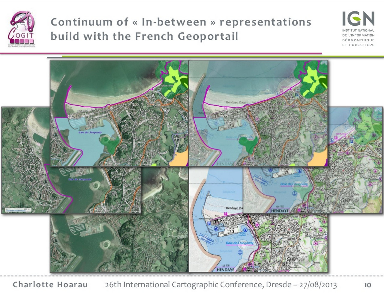
Hybrid base layer
An hybrid base layer consists of a mix of two base layer types, for instance a combination of an orthophoto base layer and of a map base layer, eg the Google hybrid mode.
As put by Charlotte Horau, IGN researcher, this approach was coined because "orthoimagery is visually complex and dark". The approach raises however "design issues due to the difficulty to symbolize vector layers in consistency with different backgrounds". [C. Hoarau, ICC 2013 : Mixing, blending, merging or scrambling topographic maps and orthoimagery in geovisualization ?]
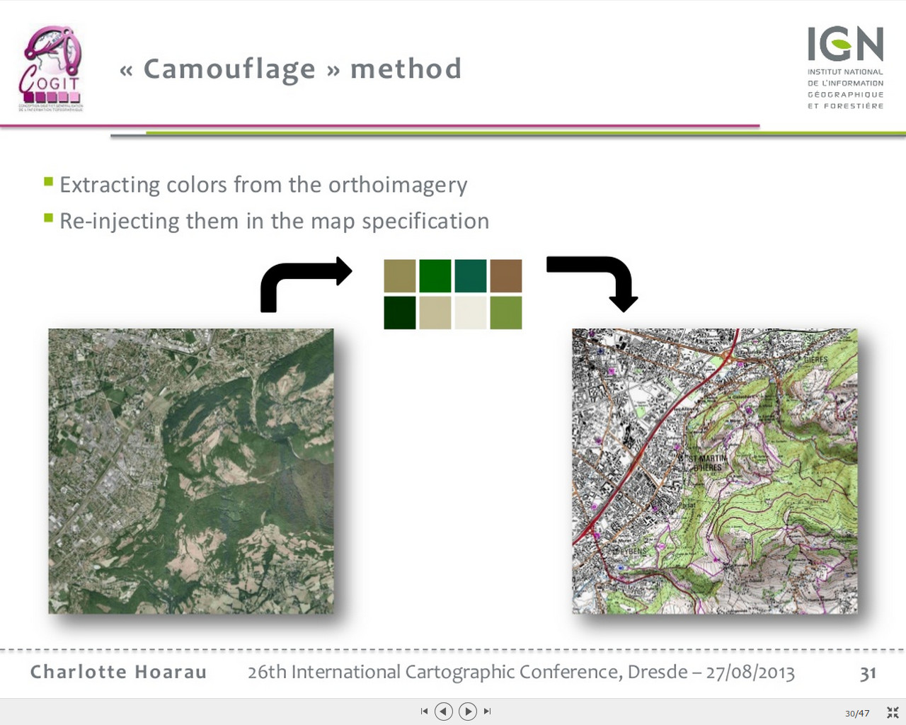
aircity airparis orthophoto + données vectorielles mode hybride de Google camouflage sertit: cyclone haiti co-visualisation orthophoto portail Lannion: passer de la carte àa la photo surgingseas maperial mapstack combinaison de fonds cartographqieus References: