Portolan chart
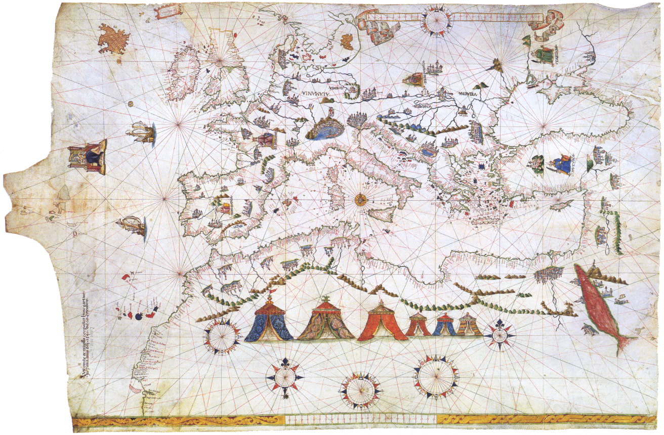
Portolan or portulan charts are navigational maps based on compass directions and estimated distances observed by the pilots at sea. They were first made in the 13th century in Italy, and later in Spain and Portugal. With the advent of widespread competition among seagoing nations in the Age of Discovery, Portugal and Spain considered such maps to be State secrets. The English and Dutch relative newcomers found the description of Atlantic and Indian coastlines extremely valuable for their raiding, and later trading, ships. The word portolan comes from the Italian adjective portolano, meaning related to ports or harbours.
Portulan charts have three graphical distinguishing features: they represent wind lines on the seas and the oceans, the port labels are displayed perpendicularly to the coast lines, and they usually include a wind rose.
Source: [Wikipedia - Portolan chart](http://en.wikipedia.org/wiki/Portolan_chart) / [Wikipedia FR - Portulan](http://fr.wikipedia.org/wiki/Portulan)